


A hike to Limekiln Lake with a very backcountry feel.
Key takeaways
- Distance: 3.7 miles round trip
- Elevation gain: 420 feet
- Hike includes bridges
Hiking to Limekiln Lake
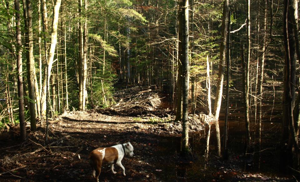
This trail does not have a trail sign at the beginning of the Moose River Plains Road; you will need to look closely for a trail disk on a tree. The trail is quite obscured by growth but once on it, it's easy to follow. This trail seems to get very little use, but is a nice trail nonetheless.
From the trailhead, you will drop slightly and quickly come to a crossing of a beaver-flooded creek. The crossing is a bit tough as the bridge has become part of the beaver dam, but take your time and it shouldn't be an issue. The opposite side is a bit wet and tough to follow for a ways but soon becomes easier. Several areas of wetlands can get flooded from beaver use where the trail comes too close to the creek, but with a bit of care it can be navigated. The trail continues to follow the valley formed by the southern flank of Fawn Lake Mountain until you reach the southeast shore of Limekiln Lake at 1.8 miles from your car.
Limekiln Lake in the winter
Moose River Plains Road is closed to the winter, only accessible via snowmobile. This trail is not recommended in the winter. Those that access the trailhead via snowmobile should be prepared for all winter conditions.
Experience more trails in Hamilton County
Looking to find some more trails to hike in Hamilton County? With hundreds of miles of trails, we can help find the perfect hike for you in the big outdoors.
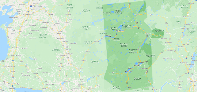
How to get there
From the intersection of Route 28 and Limekiln Road in Inlet, follow Limekiln Road to the Moose River Plains Road. Follow the Moose River Plains Road for around 3.5 miles to the trailhead on the right. There is no sign, so look for disk on a tree. Limited parking.