


The grade is quite easy as the trail to Muskrat Pond climbs over the gently rolling hills on this pleasant hike, which is mostly along an old road.
Key takeaways
- Distance: 3.4 miles round trip
- Elevation gain: 365 feet
- Hike includes a road walk and trail junctions
Hiking to Muskrat Pond
From the end of Indian River Road, at the trailhead parking, you will pass through boulders blocking the way from vehicular traffic. This is an old road, so the footing is superb.
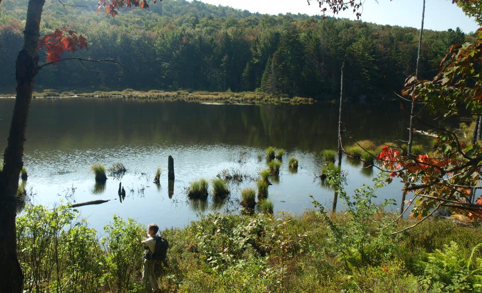
At about 1.6 miles from the parking area the Muskrat Trail comes in on the left. The side spur is marked as 0.1 mile, but it is less than that. The trail drops to the shore of the long pond. Muskrat Pond is much more attractive than the name seems to imply — the colors here in fall are quite amazing.
Muskrat Pond in the winter
This parking area cannot be reached, except via snowmobile, in the winter. This hike during the winter season is not recommended.
Experience more trails in Hamilton County
Looking to find some more trails to hike in Hamilton County? With hundreds of miles of trails, we can help you find more amazing hikes in the big outdoors.
How to get there
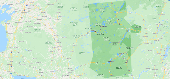
From the intersection of Route 28 and Limekiln Road in Inlet follow Limekiln Road. Continue to Moose River Plains Road on the left and follow here. Continue on Moose River Plains Road to Otter Brook Road which will be your second right. Eventually this turns into Indian River Road which you can follow to the end. These roads through the Moose River Plains are very rough, but can be driven in most cars with some care at slow speeds.